Temperatures remain warm, for now, across south Florida to start the week. It’s not for several more days before a much anticipated Cold Front arrives with noticeable cooling. High Pressure is in charge of our weather now, situated across the southeastern states.
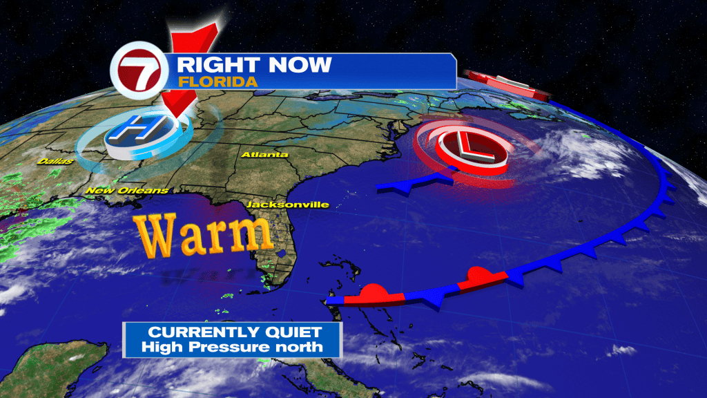
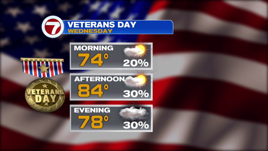
Tuesday will again be warm with tolerable humidity. Winds will remain light along with a slight chance for showers. The next change, Wednesday, will be a minor one. Moisture levels should pick up slightly so more showers should arrive on Veterans Day (as shown below).
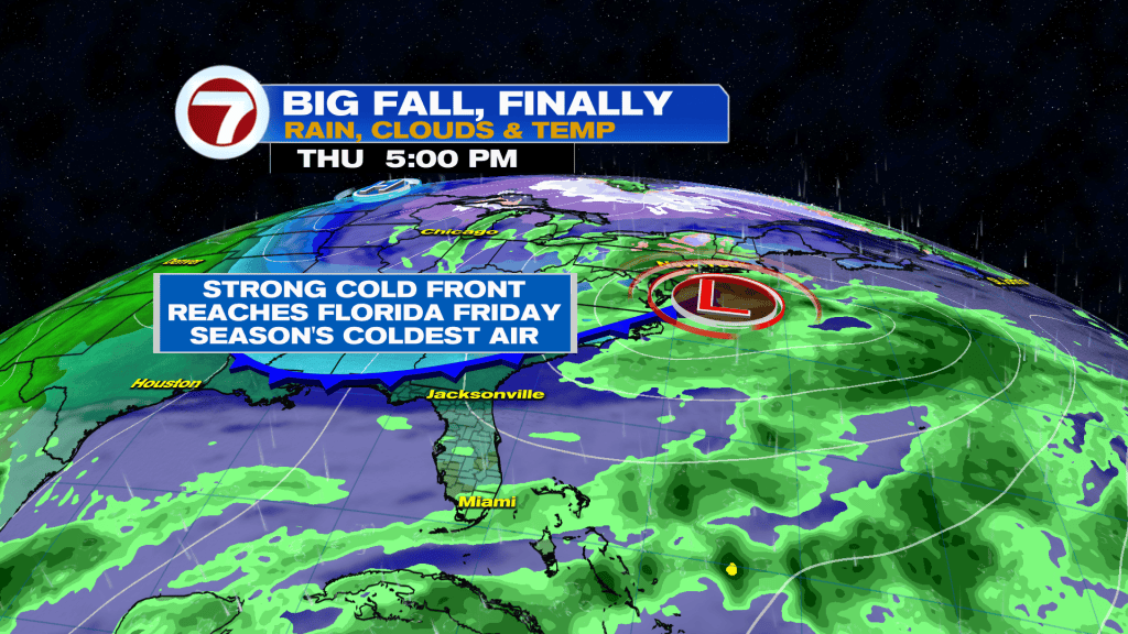
The Midweek moisture will eventually give way to much cooler and drier air. That follows the strongest Cold Front of the season, so far, reaching Florida on Friday. While timing isn’t in full scope yet, the most likely passage (for south Florida) will be from the late morning through the mid-afternoon. Clouds will accompany the Front and you’ll begin to detect a change in the air as the day progresses.
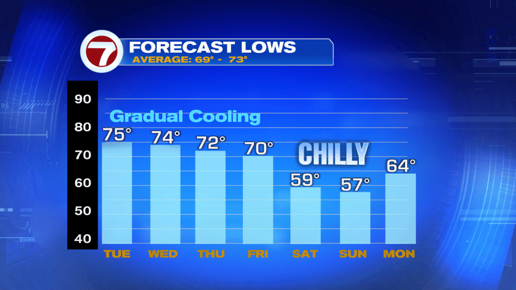
We’re expecting a brisk change, by south Florida standards, come late Friday into Saturday. Temperatures are forecast to plunge into the widespread 50’s for the Mainland, and the 60’s for the Keys. What’s notable is the fact that it’ll make for the coolest air since last March!
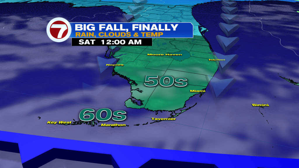
The next question is, “will the cooling stick around very long”? The answer is no. By next Monday temperatures will likely begin to bounce back due to turning winds. That means the cool weather window is confined to the weekend (for the most part) peaking Sunday morning. It’ll be a rare need to bring out jackets, at least for a couple nights and mornings during this upcoming cool snap.